The Welsh LiDAR Portal
Uncover the hidden landscape of Wales. LiDAR data at your fingertips
What is LiDAR?
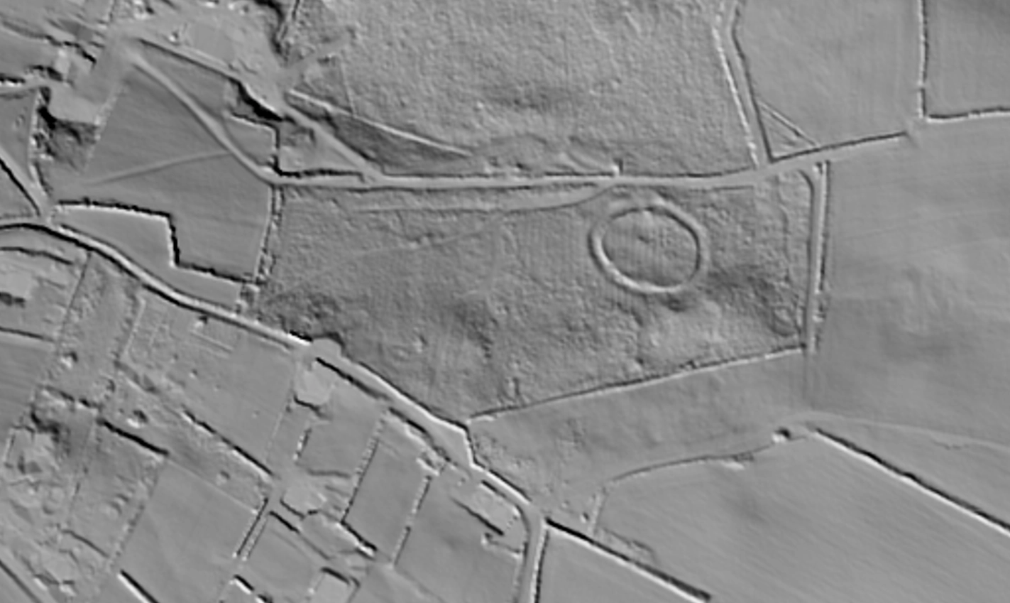
Light Detection and Ranging (LiDAR) is a cutting-edge remote sensing technology that revolutionises how we explore and map the Earth's surface. By emitting laser pulses from an aircraft and measuring the time it takes for them to bounce back from the ground, LiDAR creates highly detailed and accurate 3D maps of terrain and surface features.
While vegetation can obscure traditional aerial photography, it does not limit LiDAR. The pulses from LiDAR reflect off multiple surfaces, from the first object they encounter to the ground itself. This capability allows LiDAR to provide detailed information about features that are hidden from view, making it an invaluable tool for uncovering things that are not visible to the naked eye.
Because of its unique capabilities, LiDAR is now a vital tool for archaeologists, enabling them to uncover previously unknown historical sites. This technology opens up new possibilities for discovering and mapping ancient landscapes, revealing the secrets of the past in unprecedented detail.
ABOUT LiDARFind
LiDARFind allows you to explore Wales, revealing hidden archaeological sites. Our user-friendly platform allows both novices and experts to easily search, view, and contribute to a growing database of historical discoveries.
Using our interactive map, you can navigate through LiDAR imagery of Wales, identify potential archaeological sites, and save your discoveries. Whether you're a history enthusiast or a professional archaeologist, LiDARFind provides the tools to uncover, document, and share meaningful insights about Wales' unique historic landscape.
Every discovery you make and save contributes to a comprehensive map of Wales' hidden archaeological treasures.
User Icon
Register
Join our community of archaeology enthusiasts and professionals. Sign up today to start exploring and contributing to our extensive database of LiDAR discoveries.
Magnifying Glass Icon
Explore
Dive into our comprehensive collection of archaeological sites uncovered through LiDAR technology. Discover hidden histories and expand your knowledge.
Map Icon
Record
Contribute your own findings and expand our knowledge on this historic environment. Record and share new archaeological sites with the community using our easy-to-use platform.
Getting Started with LiDARFind
Watch our quick tutorial video to learn how to navigate and make the most of our platform. From registering and exploring archaeological sites to recording your own findings, this guide will help you get started and become an active member of our community. Dive in and discover the historic environment like never before!
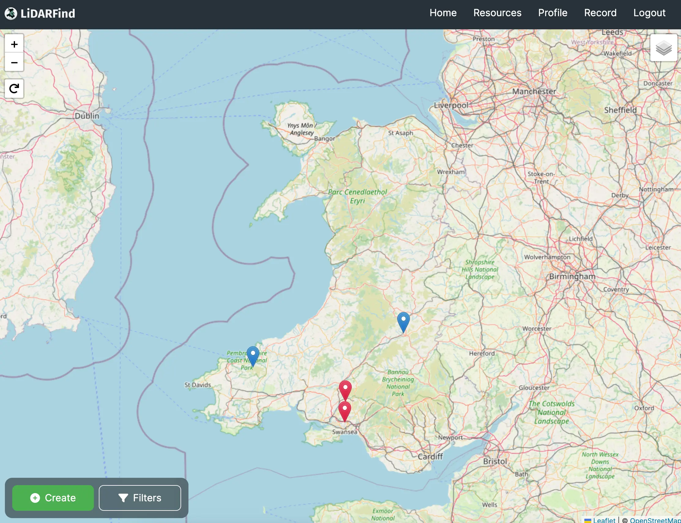
This map shows the locations of various archaeological sites. Use the filter options to narrow down the sites displayed.